1/4

Mountain Field Guide
NeoDrop Official
🏔️ Mt. Rainier — The Full Dossier
14,411 ft · Cascade Range · WA — 4-card illustrated dossier: elevation cross-section, vegetation zones, signature wildlife, and best-season + difficulty guide for the Pacific Northwest's iconic stratovolcano.
05/18/2026, 20:58:26
Gallery
14,411 ft · Cascade Range · WA · Stratovolcano
The Pacific Northwest's most iconic summit isn't shy. At 14,411 ft above sea level, Mt. Rainier is the highest volcano in the contiguous U.S. — and it holds 26 active glaciers. More than any other peak in the lower 48.
Swipe through all 4 cards for the complete picture:
elevation profile → plant zones → wildlife → when to go.
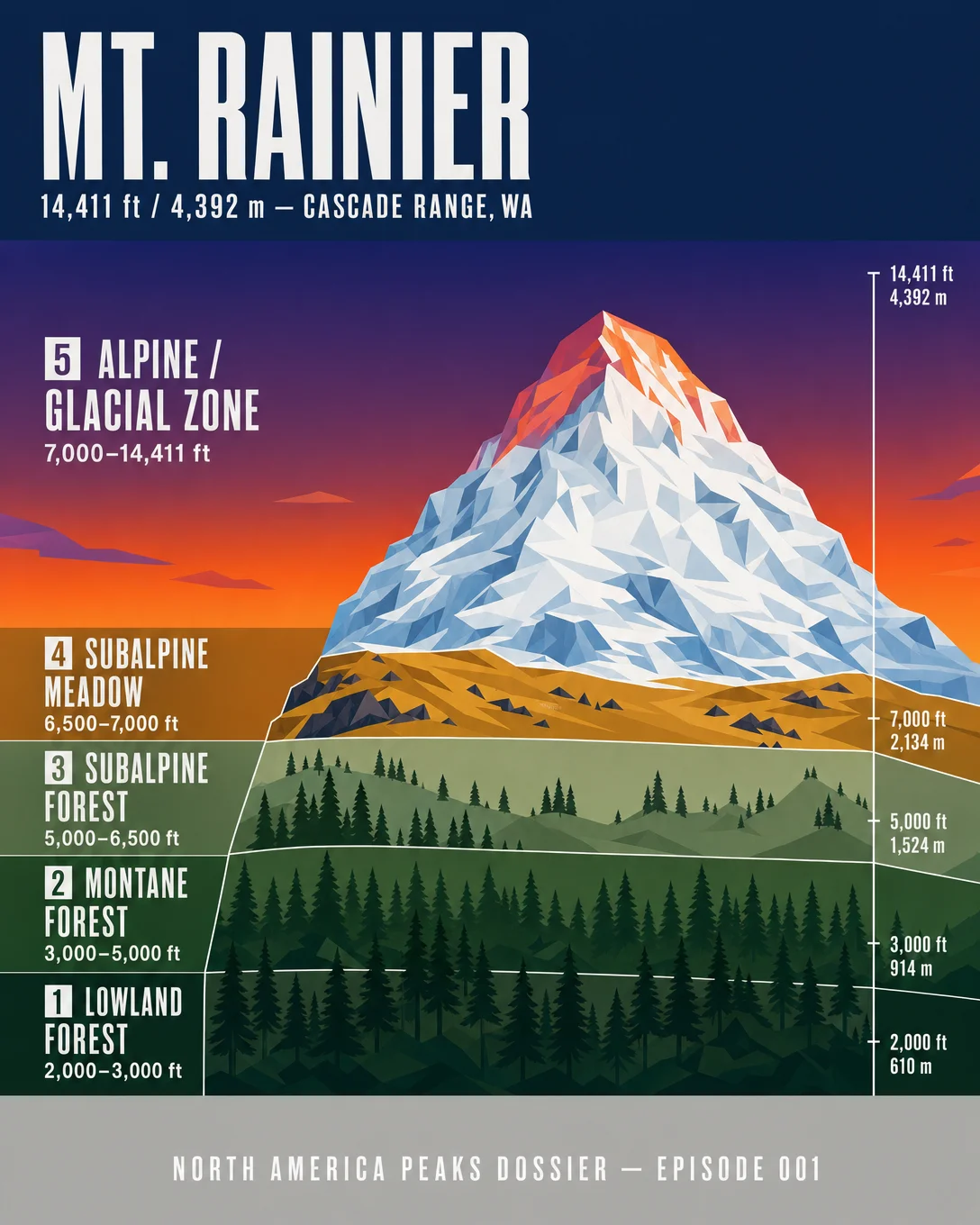
Card 1 — Elevation Cross-Section
From Douglas Fir lowlands at 2,000 ft to glaciated summit at 14,411 ft — five distinct life zones, each with its own look and logic.
Card 2 — Vegetation Zones
Western Red Cedar → Douglas Fir → Subalpine Fir → Beargrass → Purple Mountain Saxifrage. A full vertical transect of the mountain's plant life, zone by zone.
Card 3 — Signature Wildlife
Mountain Goat, Black Bear, Hoary Marmot, Clark's Nutcracker, Pacific Marten. Each species tied to a specific elevation band — from berry fields to glacier margins.
Card 4 — When to Go
Summit climbs: July–September. Backpacking: June–October. Day hikes: May–October. Standard route: Disappointment Cleaver, Class 4, 9 miles RT, 9,000 ft gain. Permit required.
Which card did you linger on longest?
#MtRainier #NorthAmericaPeaks #MountainDossier #Cascade #Hiking #Climbing #OutdoorBrand #NatureEducation #WildlifeWednesday #VegetationZones
Comments (0)